Drag and Drop
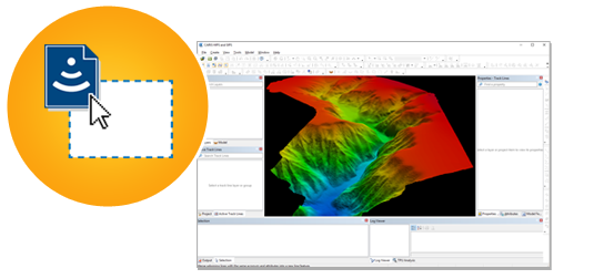 For the users looking for the easiest way to open and process their data, HIPS and SIPS now supports Drag and Drop for sensor files. When you Drag and Drop raw sensor files onto the application, the raw sensor data is automatically processed into a georeferenced point cloud and a gridded surface.
Through Drag and Drop the processing steps outlined below will be automatically applied:
- Auto-create HIPS File: The HIPS File will be automatically created
- Conversion: The raw data files will be converted in to the new HIPS File
- Vessel File From Data: For the most popular formats the installation parameters will be automatically converted from the raw data files and used during processing. For formats which do not store the installation parameters, a zero vessel file will be used
- Georeference Bathymetry: The soundings will be processed through to a georeferenced point cloud.
- Gridding: A surface will be created, using a new Automatic Resolution option.
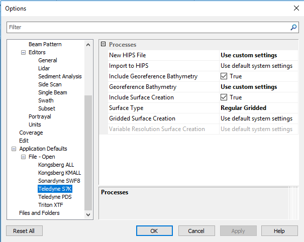
For users who would like more customization, the new combined Import Sensor Data dialogue is available. By using the same automation built for Drag and Drop, importing sensor data is now easier then ever, and by exposing several options the Import Sensor Data dialogue provides flexibility to support.
One Step Processing
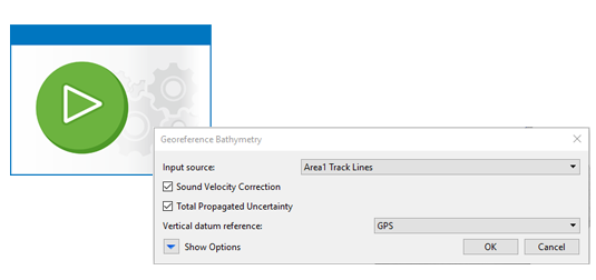 HIPS and SIPS 11.0 also introduces a new process to correct and georeference their sensor data. The new Georeference Bathymetry process is a single process which replaces Sound Velocity Correction, Load Tide, Compute GPS Tide, Merge and Compute TPU. With Georeference Bathymetry, the same trusted algorithms from the previous processes are still applied, however there are several benefits to the user by combining the algorithms into a single process:
- A simplified user interface with fewer options
- Simplified workflow with fewer decisions regarding when different processes need to be applied
- No need to concatenate Sound Velocity Profiles into a single file, simply select several separate profiles, or point to a folder and use all profiles in the folder.
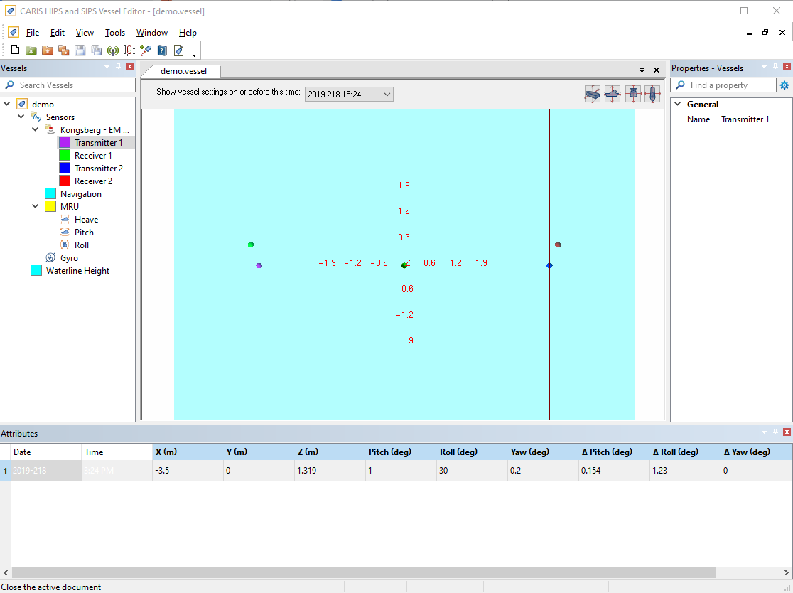
Trackline Layers
 HIPS and SIPS 11.0 introduces several user interface changes which improve the user experience while interacting with data. The new application interface provides a consistent user experience across the CARIS product line when filtering, grouping, and setting up display properties. Some of the improvements you will see are:
- Selection and draw order are controlled from a single window
- Layer grouping, with the ability to uniformly change display settings for all layers in a group
- Improved Properties and Attributes windows
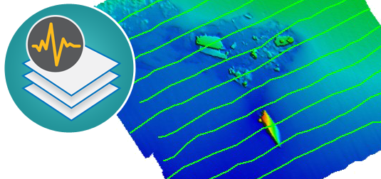
HIPS and SIPS 11.0 introduces the ability to create Dynamic or Static layers for tracklines. This allows users to create a rule based layer using any of the trackline attributes with the option for the layer to be static (the tracklines in the layer will not change) or dynamic (as new lines are added or the trackline attributes change, the layer will update). These layers can then be used to drive the editors, display and can be used as the input to a process.
For example, a dynamic layer could be created for all lines which are outdated. As lines become outdated they will be automatically added to the dynamic layer. At any time Georeference Bathymetry can be run on the layer, updating all of the outdated lines in the project.
Process Designer
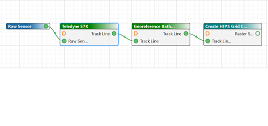 It is now possible to include a Process Model inside another Process Model using File > Insert Model. This makes it easier to manage complex Process Designer models by defining common capability once and re-using it multiple times. In the example below, a Process Model for Creating or Updating a Surface has been inserted into the main Process Model, which is clearly identified by its teal colour.
Validation has been built into the Process Designer, making it clear to a user if they have not defined a required parameter or connection. In the example below, the process is showing that it requires a connection for the "Track Line(s)" input.
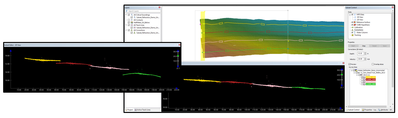 Before and after images with various corrections applied to the lines in Subset Editor
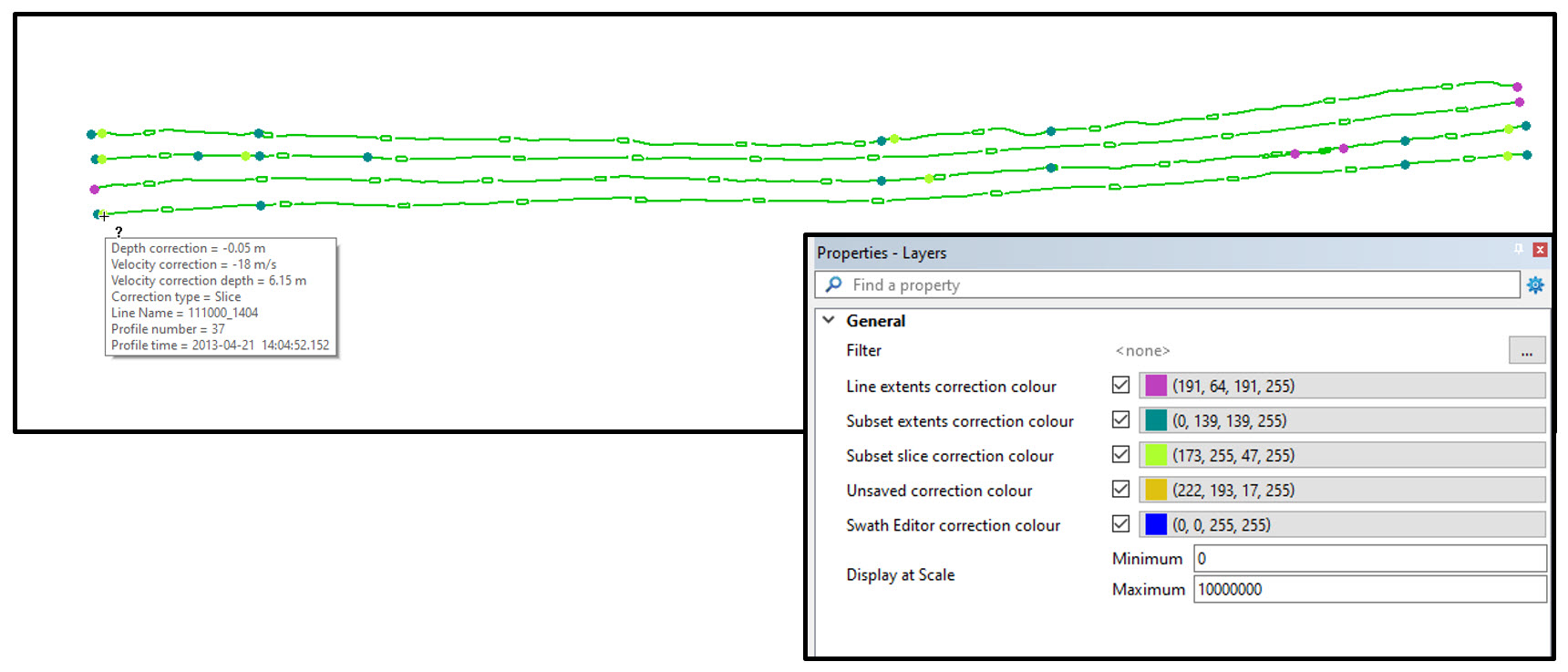 Reviewing corrections values and locations in the 2-D Map window
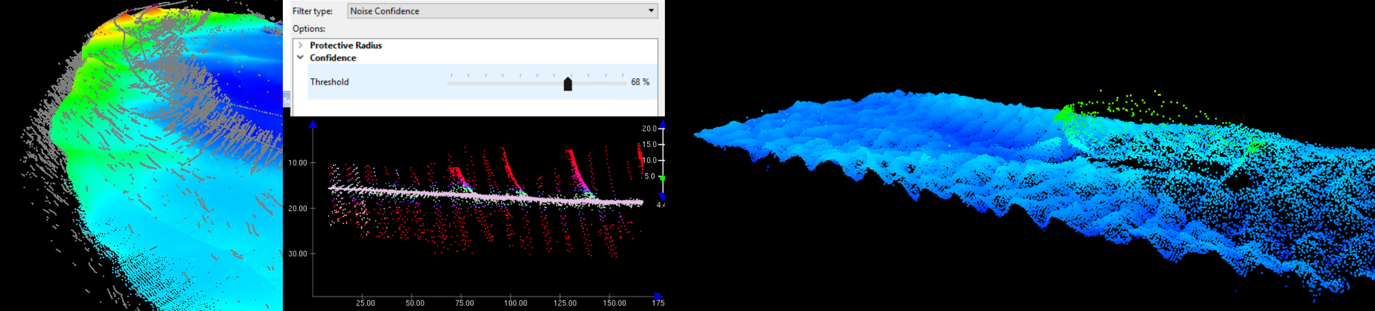
 Through a partnership with the UK Hydrographic Office, Teledyne CARIS has expanded its AI driven services offered on the CARIS Mira AI platform. The ADMIRALTY GAM Service classifies sonar noise using an enhanced Generalised Additive Model (GAM). This model works through your point cloud data adapting to identify noise within your data set. The model is a cloud-based algorithm which is securely accessed directly from the HIPS and SIPS. The algorithm assigns soundings within your point cloud as noise which can be rejected whilst running the ADMIRALTY GAM Service or can be reviewed in the Subset Editor for further evaluation.
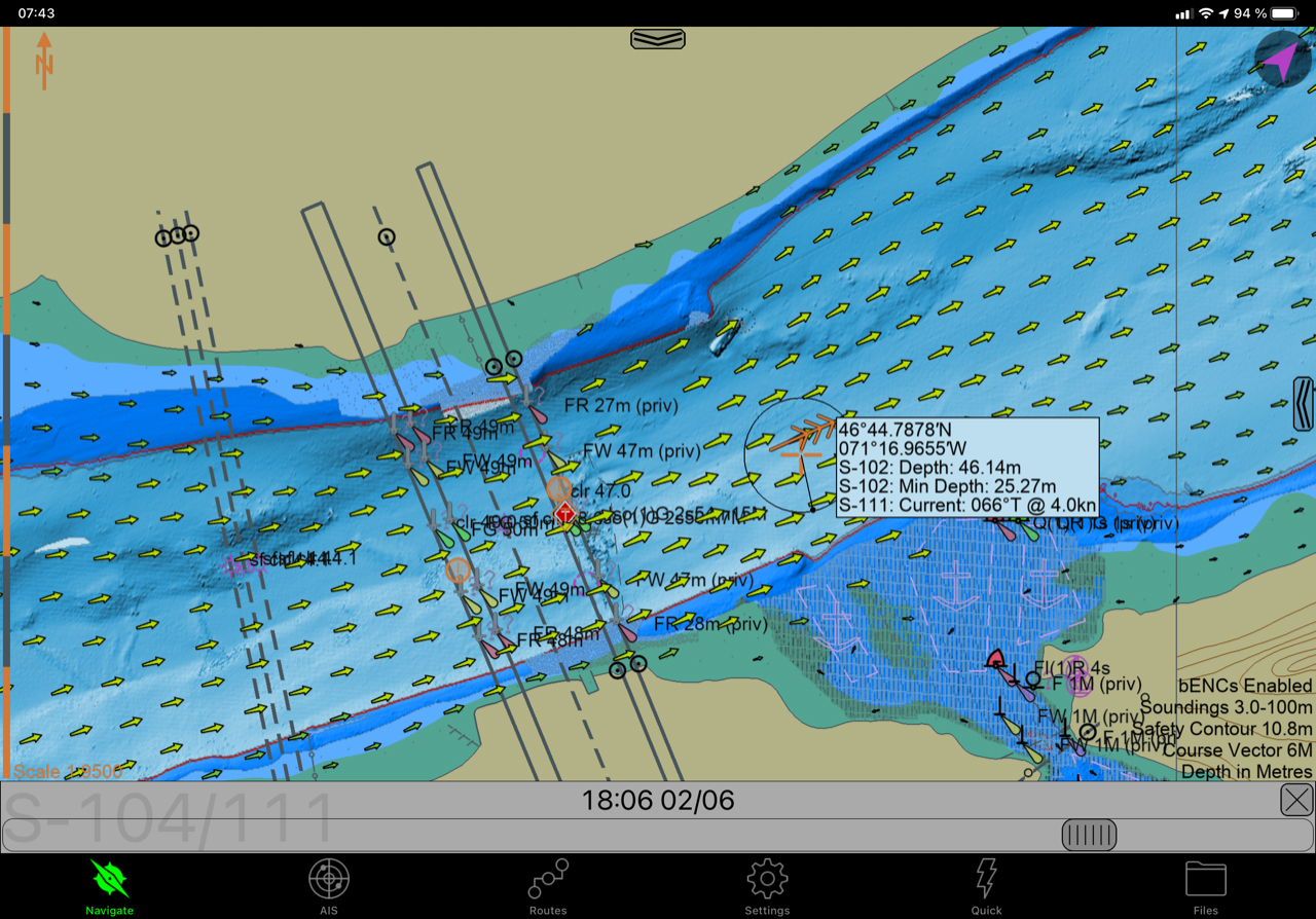 S-102 in action with S-111 overlay in SEAiq Portable Pilot Unit (captured by Pascal Rheaume)

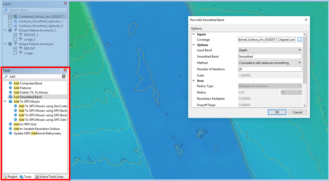 For example, users may easily add a new smoothing band to a coverage while reviewing contours for charting.
