News
CARIS Marine Spatial Data Infrastructure Solution for France
Heeswijk, The Netherlands - March 31, 2008 - CARIS, a leading developer of geomatics software, is pleased to announce it has been awarded a contract by the Service Hydrographique et Océanographique de la Marine (SHOM) to deliver a Marine Spatial Data Infrastructure (MSDI) to access its hydrographic information. CherSoft as a subcontractor will supply a tide database as part of the solution.
The Launch of the project occurred in mid-February for a week, with focused meetings on project strategy and benefits. Through this contract, referred to as INFRAGEOS-H (Infrastructure Géospatiale du SHOM for Hydrographic data), CARIS will deliver a technological infrastructure built on CARIS bathymetric and hydrographic data management software, Bathy DataBASE, CARIS Hydrographic Production Database, and Web-mapping software, Spatial Fusion Enterprise, and the CherSoft tide database to produce this MSDI.
The MSDI will be a central, interoperable source for all SHOM hydrographic geospatial information. The data and information housed in the MSDI will be accessible at SHOM, from the regional hydrographic units and even in the field by survey platforms.
In its beginning, this MSDI will maintain Bathymetry, Navigational Aids and Tide data in the central database. It will be accessible through thick desktop clients for quality control purposes, via industry standard formats like IHO S-57 and Bathymetric Attributed Grid (BAG), or via thin web clients for browse and download purposes utilizing Open Geospatial Consortium, Inc.® (OGC) formats like WMS and WFS.
Potential for future discovery of the data to exist in the MSDI was paramount to SHOM. To aid this data discovery ISO 19115 metadata will be captured for the information that is to reside under the MSDI.

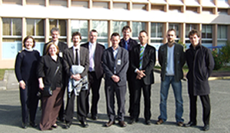
The INFRAGEOS-H project was launched at the Établissement Principal du Service Hydrographique et Oceanographique de la Marine (SHOM), in Brest, France in mid-February.
Join our Mailing List
Subscribe to email announcementsOur Latest Tweets
Tweets by Teledyne CARIS Follow us on TwitterConnect With Us

