News
Land and sea data workshop
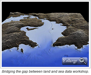
 Historically, land and sea data sets have been manipulated separately and the merging of data proved to be challenging. However, many of the technical challenges can be addressed by today’s geospatial software allowing agencies to benefit from combining data sets that cover terrestrial and marine areas.
CARIS will be hosting a half-day workshop titled, Bridging the gap between land and sea data, at CoastGIS 2013 being held in Victoria, British Columbia, Canada on June 18-21, 2013.
The workshop, which will be held on June 18, will focus on the workflow for merging land and sea data using CARIS Bathy DataBASE. Workshop topics will include:
- Importing land and sea data
- Working with point cloud and gridded data sources
- Performing a vertical datum shift
- Creating Triangulated Irregular Network (TIN) models
- Creating Digital Elevation Models (DEM)
- Combining surfaces to form a single surface
- Interrogating the dataset in 3-D
- Data distribution
Participants can register to attend this informative workshop whether or not they are able to attend the full conference. To register, visit the CoastGIS website.
Join our Mailing List
Subscribe to email announcementsOur Latest Tweets
Tweets by Teledyne CARIS Follow us on TwitterConnect With Us

