News
CARIS attends Southern Africa and Islands Hydrographic Commission meeting
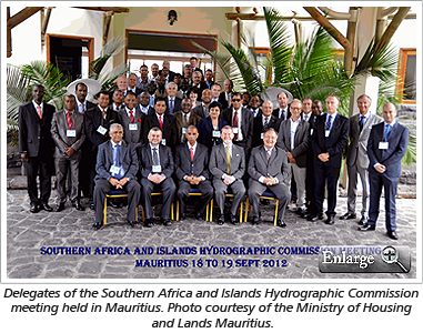
 CARIS recently attended the Southern Africa and Islands Hydrographic Commission (SAIHC) meeting held in Mauritius. The SAIHC is one of the International Hydrographic Organization’s (IHO) Regional Hydrographic Commissions and is an annual gathering of hydrographic offices in the region to discuss ongoing hydrographic issues. The meeting was organized by the Ministry of Housing and Lands in Mauritius and representatives from African countries, island states and European countries with territories/interests in the region were in attendance.
During the meeting, CARIS BV’s Charles de Jongh presented a pilot project that was recently executed and finalized at the hydrographic office in Mozambique, to create and implement a database with seamlessly combined topographic and bathymetric elevation models using CARIS Bathy DataBASE. The TopoBathy database is used to manage, analyze and visualize geospatial data. It helps to protect coastal zones from natural disasters, like flooding, and was of special interest to countries participating at SAIHC that have vulnerable coastlines.
Join our Mailing List
Subscribe to email announcementsOur Latest Tweets
Tweets by Teledyne CARIS Follow us on TwitterConnect With Us

